
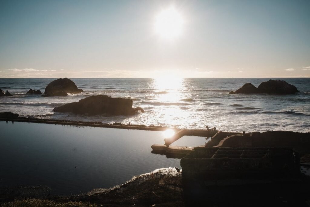
Lands End sits at the northwest corner of San Francisco, in the Golden Gate National Recreation Area. The National Park Service (NPS) describes trails that wind along rocky cliffs above the ocean, through cypress and eucalyptus groves, with views of the shore, headlands and Golden Gate. Compare it with other outings in beaches and waterfront walks, or see the nearby Richmond District.
Trail Facts
| Item | What the agency says |
|---|---|
| Coastal Trail length | 1.7 miles (2.7 km) one way |
| Surface | Compacted aggregate and pavement |
| Slope | Average 3.4 percent, maximum 18.5 percent |
| Stairs | Yes. NPS warns that the trail has sections with stairs. |
| Mile Rock Trail (side trail) | 0.30 miles round trip, rated easiest; native and sand surface; ends at a small rocky beach |
| Mile Rock descent | Parks Conservancy lists an elevation loss of 165 feet |
NPS: Eagle Point trailhead and Coastal Trail
Parks Conservancy: Mile Rock Trail
NPS recommends walking north on the Coastal Trail. The El Camino Del Mar Trail links the Legion of Honor overlook back to Lands End.
Where to Park and Start
- The Merrie Way parking lot is the main trailhead (Parks Conservancy).
- A second lot at the end of El Camino Del Mar has stair access to the trails (Parks Conservancy).
- NPS lists parking at the USS San Francisco Memorial, the Lands End Lookout Visitor Center and along El Camino Del Mar.
- Wheelchair-accessible trails start at the Merrie Way trailhead.
Lands End Lookout
The Lookout is the park’s visitor center, where you can learn the area’s natural and cultural history. The Parks Conservancy lists it as ADA accessible, with exhibits, a gift shop, a stone sculpture of Diana, and windows with views of the Pacific coast. It opened on April 28, 2012. NPS lists exhibits on history, artifacts, landscapes and geology, and a recorded audio tour from staff. Both agencies list opening hours of 9 a.m. to 5 p.m.; see “What We Could Not Verify” below. Phone: (415) 426-5240.
Parks Conservancy: Lands End Lookout
NPS: Lands End Lookout Visitor Center
Sights Along the Way
- USS San Francisco Memorial: a WWII cruiser memorial with an improved overlook next to it (NPS).
- West Fort Miley batteries: a grassy picnic area among three turn-of-the-century gun emplacements (NPS).
- Ohioan shipwreck viewpoint: stairs lead down from the Merrie Way lot; the wreck is visible at low tide (Parks Conservancy).
- Mile Rock Trail: a short side trail off the Coastal Trail to an overlook of the Golden Gate Bridge and Marin Headlands, continuing down to a small rocky beach (Parks Conservancy).
The Sutro Baths Ruins
NPS says the Baths opened in 1894, covered about three acres and held seven pools at different temperatures. They were later turned into an ice-skating rink, and a fire destroyed what remained in 1966. The ruins have been part of the Golden Gate National Recreation Area since 1973. The NPS page describes the historic design, not current access, so check conditions at the Lookout.
Safety
- NPS says to stay on trails and keep your distance from cliffs.
- River otters can approach people. The Parks Conservancy says to keep a safe distance and report encounters to Park Dispatch at 415-561-5510. Feeding or approaching wildlife violates federal law.
- NPS park headquarters: 415-561-4700. U.S. Park Police emergency: 415-561-5656.
For a bigger day out, pair this with the Presidio, or read our guide to San Francisco views.
What We Could Not Verify
- Lands End Lookout visitor center days and hours. The NPS place page says 7 days a week, 9 a.m. to 5 p.m.; the Parks Conservancy page says daily, 9 a.m. to 5 p.m. We could not find a closure or holiday schedule. Call (415) 426-5240.
- Park hours. The NPS hours page lists Lands End among areas open 6 a.m. until 1 hour after sunset, while the Parks Conservancy page says open 24/7. We do not state one.
- Stairs count and where the stairs fall on the Coastal Trail. NPS says the trail has sections with stairs; it gives no count.
- Tide and beach safety for Mile Rock Beach. Neither agency page we checked gives tide guidance for the beach. Check with a ranger before going down to the water.
- The Lands End labyrinth (Eagle’s Point). Our official pages did not describe it, so we do not give its location or distance.
- Restrooms and dog rules. The pages we checked do not cover them; the Parks Conservancy and NPS pages did not list them.
- Current trail closures. NPS links a Trail Closures and Updates page; check it on the day.
- Stair access details for the El Camino Del Mar lot beyond the Parks Conservancy statement that it has stair access to the trails.
Frequently Asked Questions
How Long Is the Lands End Coastal Trail?
NPS lists the Coastal Trail at 1.7 miles (2.7 km) one way. The Mile Rock side trail is a further 0.30 miles round trip, according to the Parks Conservancy.
Is the Trail Wheelchair Accessible?
Wheelchair-accessible trails start at the Merrie Way parking lot trailhead, according to NPS and the Parks Conservancy. NPS also warns that the Coastal Trail has sections with stairs.
Where Do I Park?
The Merrie Way lot is the main trailhead. A second lot at the end of El Camino Del Mar has stair access to the trails. NPS also lists parking at the USS San Francisco Memorial and the Lookout.
What Is the Surface Like?
NPS describes it as compacted aggregate and pavement, with an average slope of 3.4 percent and a maximum of 18.5 percent. The Mile Rock side trail is native and sand.
Checked on 27 October 2026 against the National Park Service Lands End, Eagle Point trailhead, Lands End Lookout, hours and Sutro Baths pages, and the Golden Gate National Parks Conservancy Lands End, Lookout and Mile Rock Trail pages.
Sources
More Guides
Presidio Ghosts and the Pet Cemetery: Legends and Facts
The Presidio’s ghost stories and the Pet Cemetery legends, told as stories and then checked against the Presidio Trust and National Park…
Read the guide →Chinatown Tunnels Myth: What Is Under Grant Avenue
The claim that a maze of tunnels runs under San Francisco Chinatown, traced to 1800s tour guides, and what SFGATE and KALW…
Read the guide →Is Coit Tower a Fire Hose Nozzle? The Legend and the Facts
The story that Coit Tower was shaped like a fire hose nozzle to honour firefighters, and what San Francisco Recreation and Parks…
Read the guide →Questions People Ask About Lands End Trail: San Francisco’s Wild Northwest Corner
How long is the Lands End Coastal Trail?
NPS lists the Coastal Trail at 1.7 miles (2.7 km) one way. The Mile Rock side trail is a further 0.30 miles round trip, according to the Parks Conservancy.
Is the trail wheelchair accessible?
Wheelchair-accessible trails start at the Merrie Way parking lot trailhead. NPS also warns that the Coastal Trail has sections with stairs.
Where do I park?
The Merrie Way lot is the main trailhead. A second lot at the end of El Camino Del Mar has stair access to the trails. NPS also lists parking at the USS San Francisco Memorial and the Lookout.
What is the surface like?
NPS describes compacted aggregate and pavement, with an average slope of 3.4 percent and a maximum of 18.5 percent. The Mile Rock side trail is native and sand.
More to Explore
Happening Soon
- Treasures of the Pharaohs Sat, Aug 1, 2026 – Jan 31, 2027 · de Young Museum
- Ferry Plaza Farmers Market Sat, Sep 12 – Dec 31 · Ferry Building Plaza
- Heart of the City Farmers Market Sun, Sep 13 – Dec 31 · Fulton Plaza, Civic Center
- SF State Observatory Public Nights (Wed–Fri, through Dec 4) Thu, Oct 1 – Dec 4 · SF State Observatory, Thornton Hall
Places to Check Out
- Aquarium of the Bay Attractions
- Asian Art Museum Museums
- Balmy Alley Murals Attractions
- Berggruen Gallery Art Galleries
Cite this page: Project SF, “Lands End Trail: San Francisco’s Wild Northwest Corner”, projectsf.com/guides/lands-end-trail-guide/ (updated ).